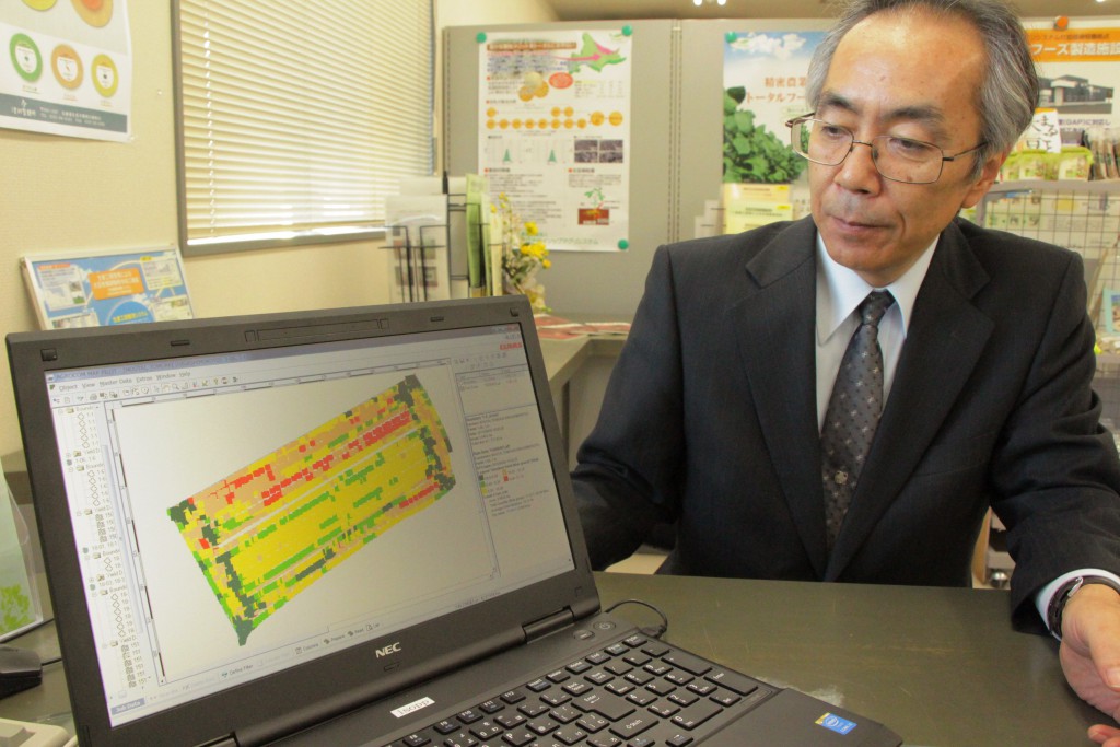
An official of Isopp Agri System based in Kitami, Hokkaido, shows a wheat crop yield map of a 2.6-hectare field on a computer
Isopp Agri System, an agricultural production corporation in Kitami, Hokkaido, has developed a map showing soybean and wheat crop yields by different colors. Through making field distribution visible, the firm hopes to utilize the data to work out manuring strategies for next year. The firm generated yield maps using a Global Positioning System-equipped large-size combine harvester which it purchased from German firm Claas. It is the first Japanese company to import a combine to create yield maps, according to the firm.
The combine, while it harvests crops, identifies location information using high-precision Real Time Kinematic (RTK) GPS and divides a field into five colors for every 10 square meters according to yields. For example, if the amount of harvest of soybeans or wheat before drying was 1,200 kg or more per 10 ares, the area will be colored red, and the area will be colored yellow if the yield was between 1,020 and 830 kg and dark green if the yield was 640 kg or less.
This year, the firm created yield maps for 30 hectares of wheat crops and 10 hectares of soybean crops. It plans to increase the amount of manure applied before sowing on the areas colored yellow and green where the yields were low.
The system “enables us to obtain yield data quite accurately,” stresses Hitoshi Sugawara, the firm’s manager in charge of precision agriculture. “We hope to utilize the data to reduce falling down of plants and improve yield rates.”
The combine harvester, priced roughly JPY50 million, is capable of cutting swaths 5.5 meters wide and is equipped with an automatic steering system. The firm bought the machine as part of the farm ministry’s robot technology verification test project.
(Nov. 21, 2015)

