Tomokatsu Sowa
Bragin is a district located in Belarus’ Gomel region 40 km north of the Chernobyl nuclear power plant. After the nuclear accident, one-third of the district which was located within 30 km of the plant has become an off-limit area and its population dropped to 30 percent of the level before the accident. The area of uncultivated land expanded.
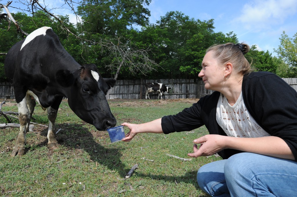
Looking at the cattle relaxing in rich, green pastures, 52-year-old Yurij Shpilevsky and his wife Tatiana say the place would have become devastated if nothing had been done. They currently raise 10 Holstein cattle and grow grass on a 20-hectare farmland.
Shpilevsky, who used to work in a nuclear plant, moved to the district after the accident and started farming seven years ago, using the government’s business support program. He encountered a variety of hardships farming on land with high levels of radioactive contamination. Grass grown in the area contains cesium five times the legal safety limit – 165 becquerels per kg. If cattle are grass-fed, it would lead to secondary contamination of milk.
The government gives ferrocene, a cesium adsorbent, to milk producers with a possibility of cesium levels in their milk exceeding the safety limit, in a similar way as Japan uses Prussian blue. If ferrocene is mixed into the feed, it will adsorb cesium in cattle’s stomach and intestines and avoid it from being taken in to the blood.
Shpilevsky spent several years to figure out the most suitable amount of ferrocene to give to his cattle. The test conducted in late July showed that the concentration of cesium in his milk was 10 becquerels per kg, much less than the safety limit of 100 becquerels per kg. He says he is now confident that he can overcome hardships.
Government’s institutes dealing with problems related to the nuclear accident concentrate in Gomel, the region hardest hit by the nuclear disaster. The government also leads efforts to revitalize farming, the nation’s main industry.
The government takes measures to cope with radioactive substances according to the soil contamination map. They divide farmlands into 10-hectare lots, measure radiation levels in each lot and show the results in different colors in the map. The map is updated every four years, and the latest version was made in 2010.
Based on the map, the government supervises farmers on how to treat their farmlands, such as whether they can cultivate their land or not, which items they should grow and ways to improve their soil by using kalium. The use of ferrocene is also one of such measures.
Farm products are tested and shipped to markets with certificates assuring safety. The frequency of the tests ranges from one to four times a year according to the radiation levels in soil and crops. All the costs are covered by the government.
Among farm products, radiation level in pasture grass has the highest possibility of exceeding the safety limit. If high levels of cesium are detected, farmers take necessary measures such as conducting reversal tillage on the 30 to 40 cm of surface soil or changing crops to products which do not easily absorb cesium, such as corns.
In Japan, the Ministry of Agriculture, Forestry and Fisheries and the Fukushima prefectural government made a soil contamination map in fiscal 2011. But the map is considered rather impractical, as it only covers 2,247 points in the prefecture. Some private organizations, such as an agricultural cooperative JA Shin Fukushima, have set on creating their own maps, but it requires a great deal of work.
Hiroo Kanno, 71, chairman of a regional development promotion council in Watari, Fukushima, joined the delegation out of fear that the district might deteriorate due to harmful rumors. In Watari, as much as 80 percent of farmers refrained from planting rice this year because of such rumors. Kanno stressed that there is a pressing need for the Japanese government to take the lead in resolving the problem of harmful rumors by conducting specific measures which meet the different conditions of soil and crops.
(Aug. 8, 2013)


